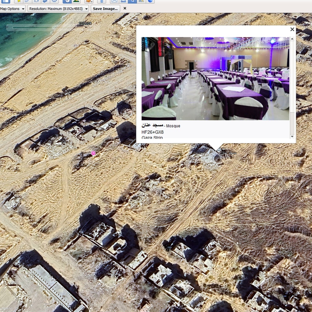
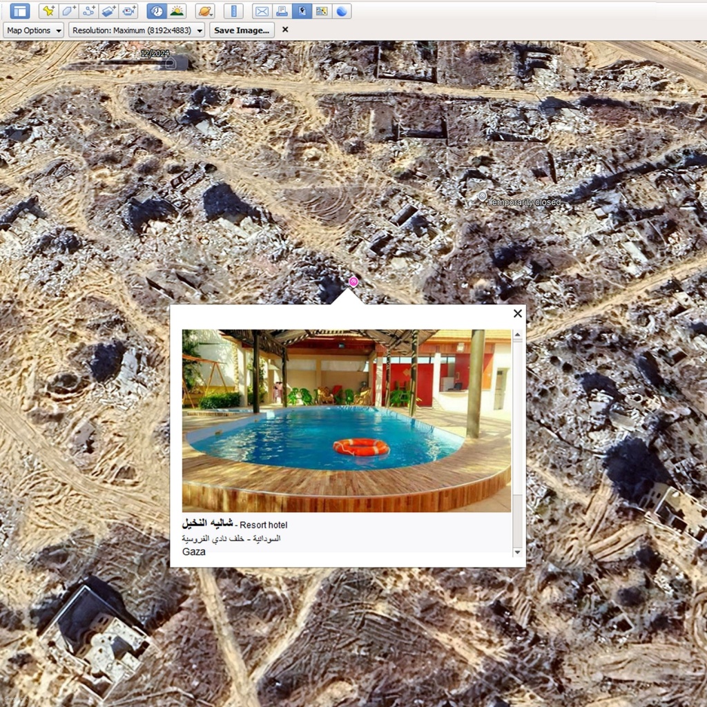
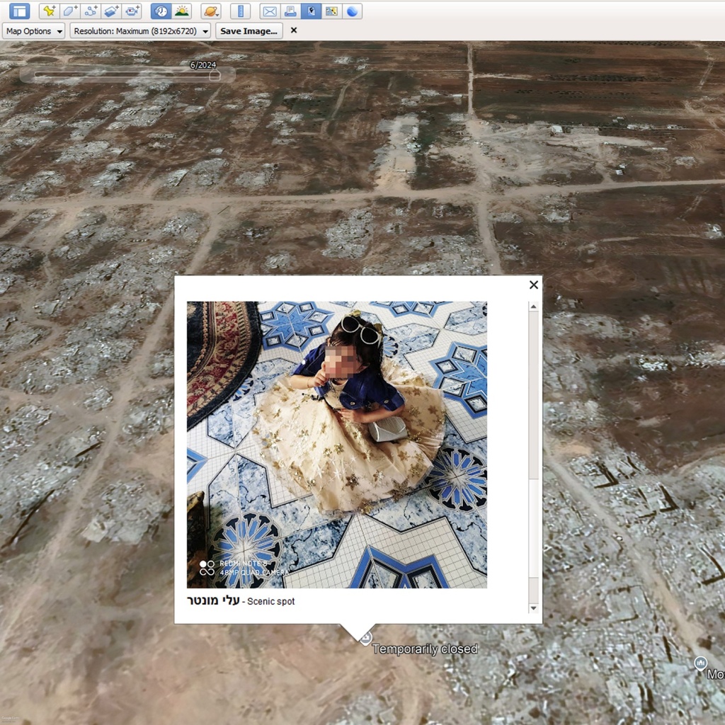
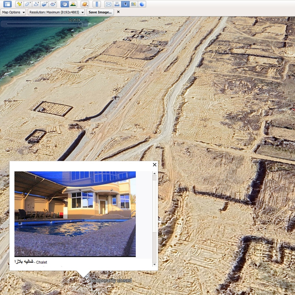
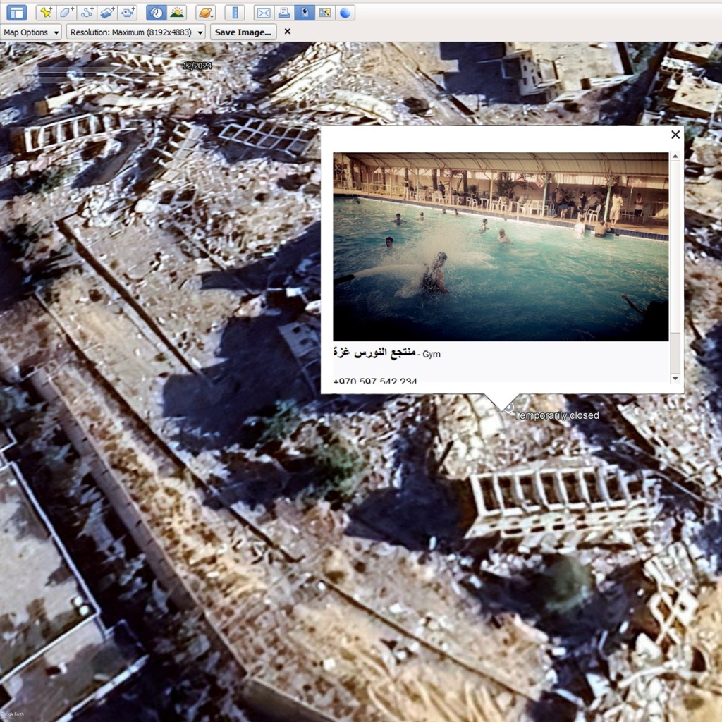
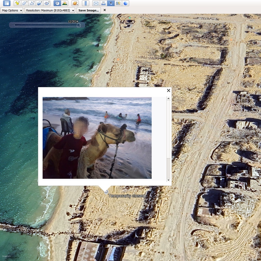
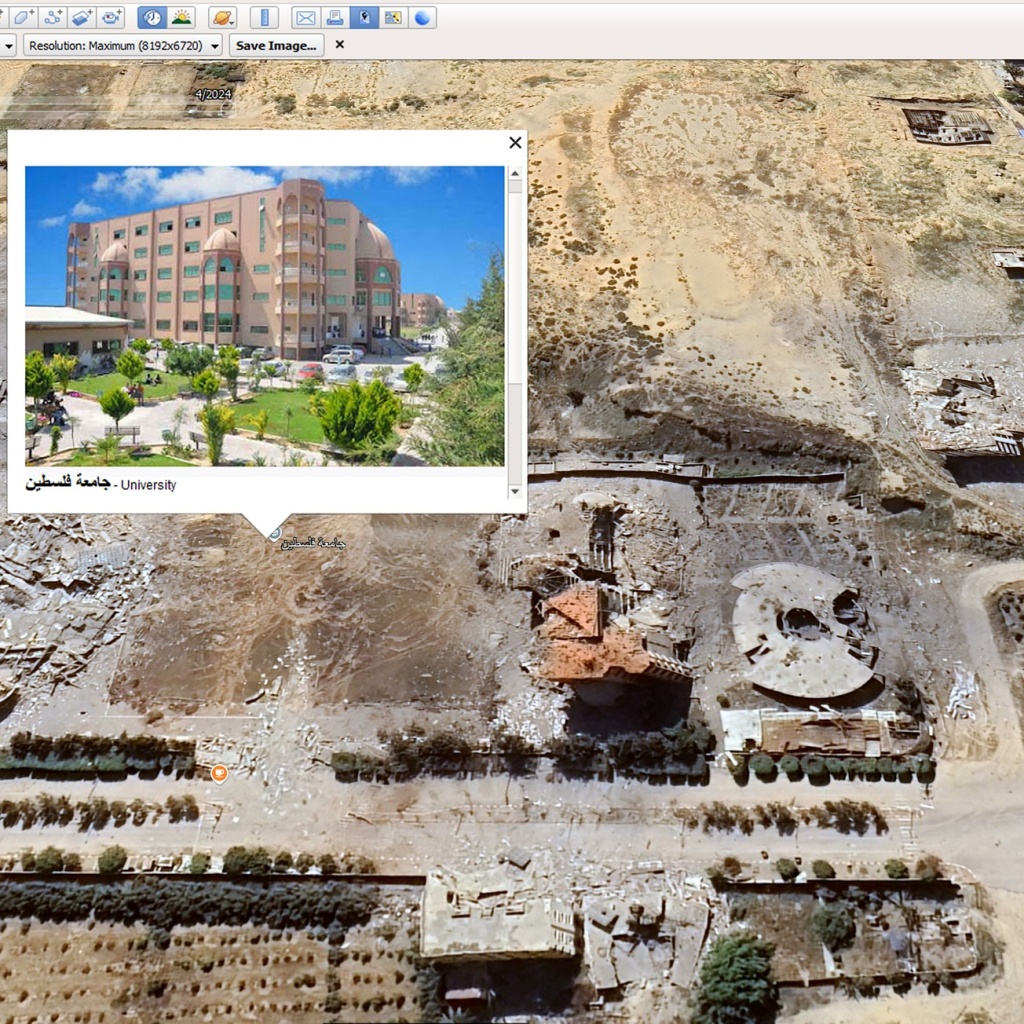
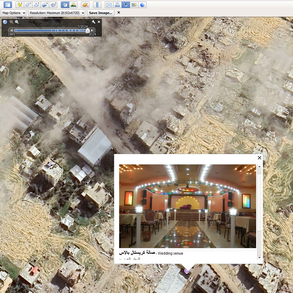
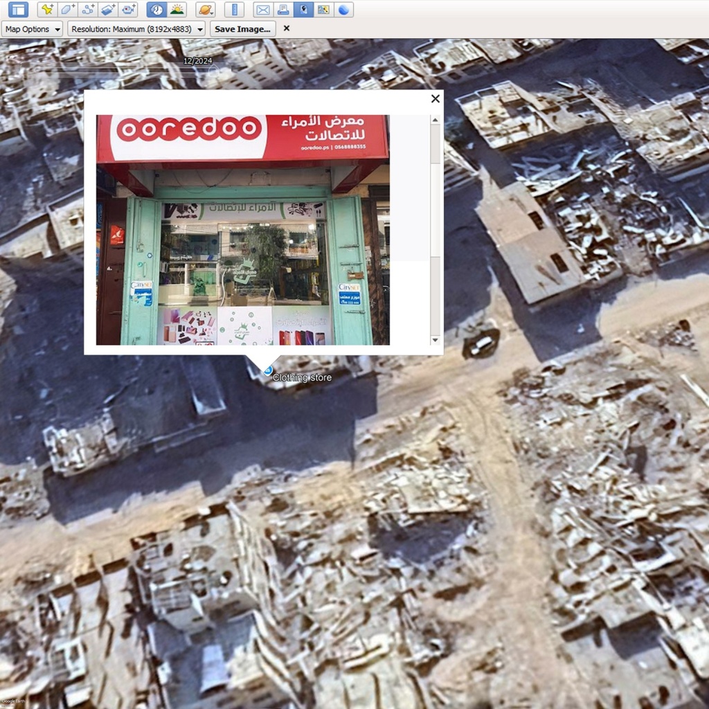
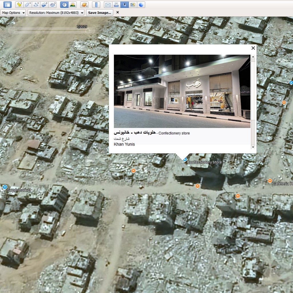
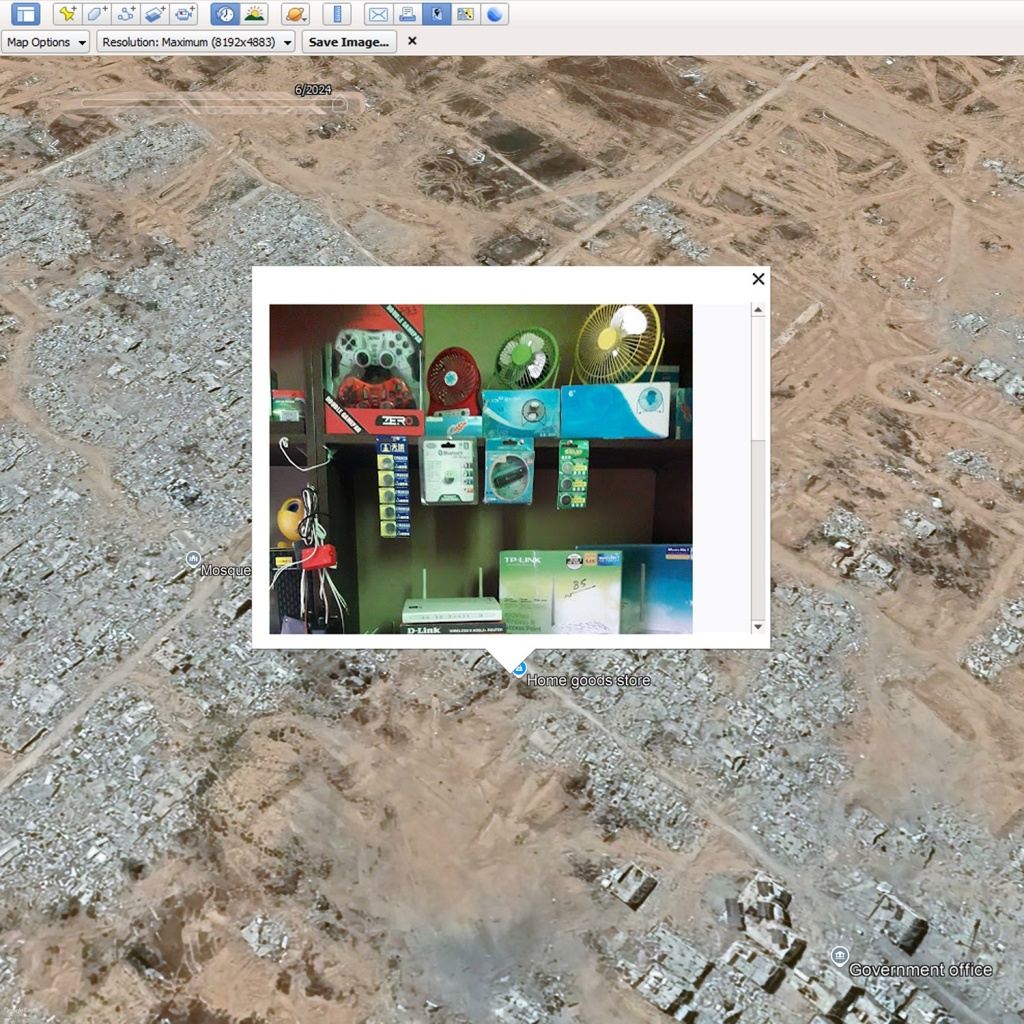
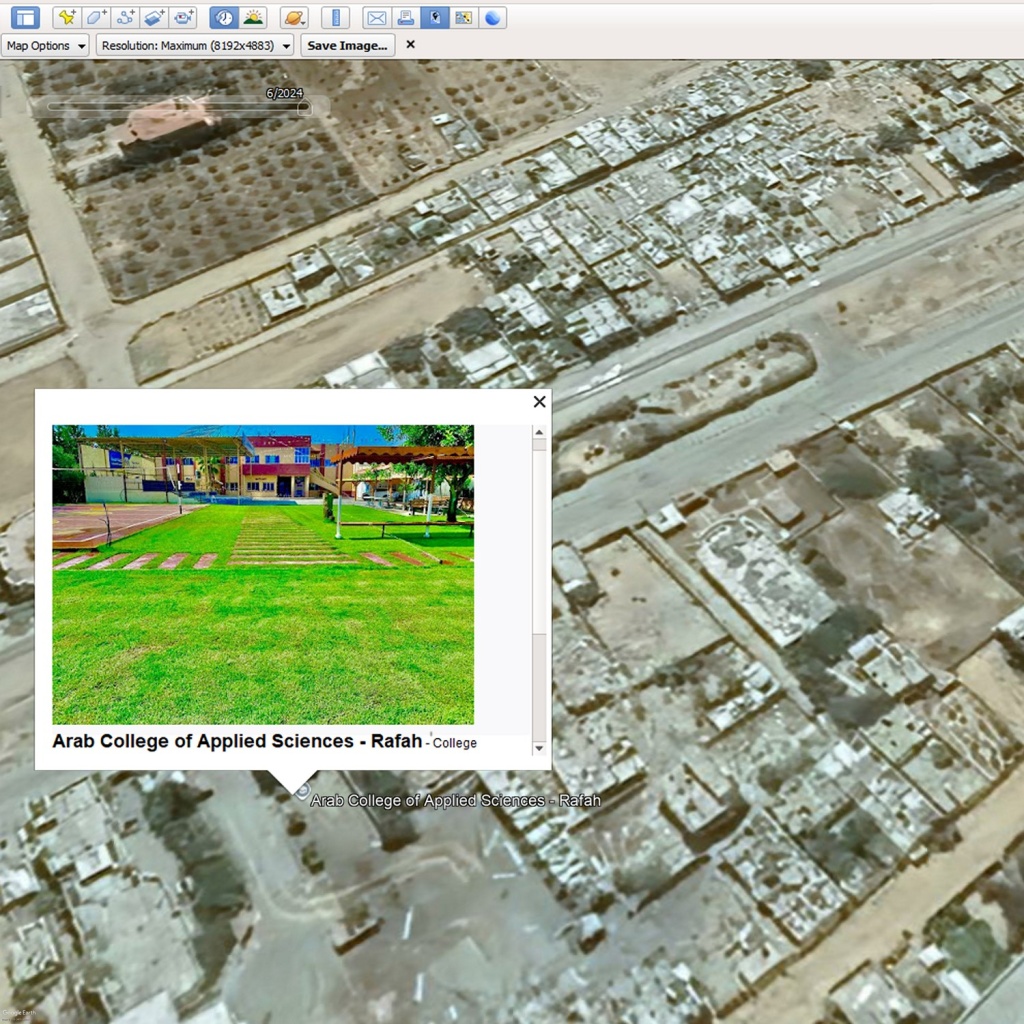
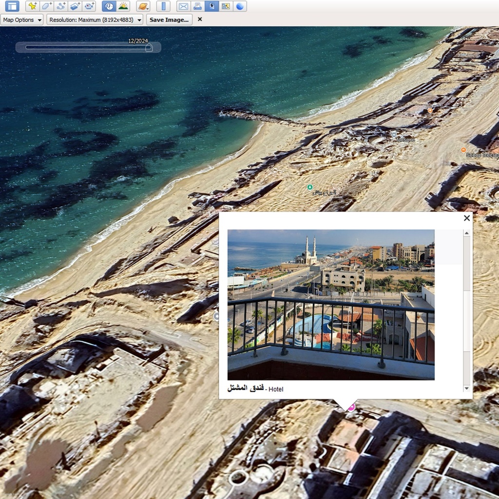
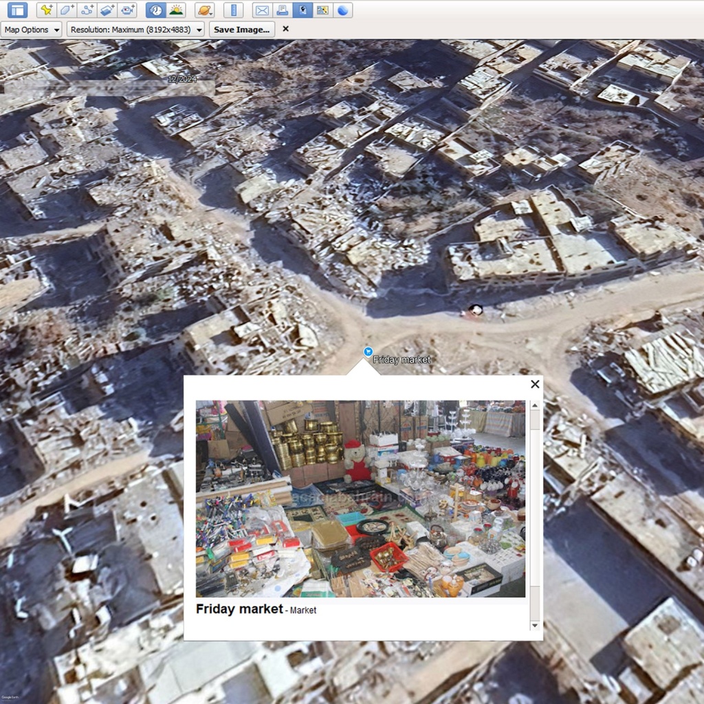
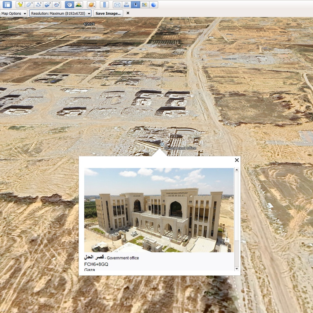
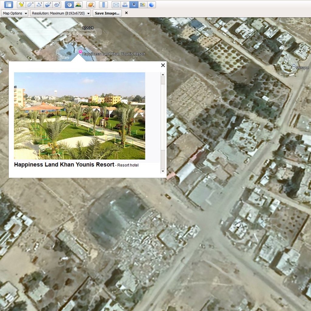
Google released satellite imagery in 2025 that updated aerial views of Gaza. These showed the level of destruction on the ground by the Israeli Defence Forces that was initiated after the horrific targeting of civilians by Hamas on Oct 7th 2023. Meanwhile the images uploaded by ordinary people that describe previous existence and businesses in the area are still available, documenting a life that is no longer possible. On Googles maps many of these places have been labelled as ‘temporarily closed’.
Six months in, Brookings Institute labelled this as Israel’s ‘scorched earth offensive’. This tactic is described as destroying anything that allows an enemy to fight a war including water, food, animals and infrastructure.
The 1977 Geneva Conventions ban warfare methods such as this, the additional Protocol 1 stating “It is prohibited to attack, destroy, remove or render useless objects indispensable to the survival of the civilian population … whether in order to starve out civilians, to cause them to move away, or for any other motive.”
sources: Google Earth, Airbus